
Incorporation of Geologic Data into Centralized Database
Project # 23-062 | Year 1 of 2
Devon Smith, Justin Reppart, Andrew Miller, Jennifer Larotonda, Matthew Dietel, Carson Schuetze, Marc Llanes
Nevada National Security Sites (NNSS)
This work was done by Mission Support and Test Services, LLC, under Contract No. DE-NA0003624 with the U.S. Department of Energy, the NNSA Office of Defense Programs, and supported by the Site-Directed Research and Development Program. DOE/NV/03624–1932.
Abstract
Seismic wave propagation and gas migration are critical factors for monitoring underground nuclear explosions. Because these factors are influenced by the geologic media with which they interact, geologic data and 3D subsurface geologic modeling play a critical role in nuclear treaty monitoring. The Nevada National Security Site (NNSS) has accrued an exceptional suite of subsurface data through over 60 years of drilling in support of many projects. Historically, drilling data has been managed as part of individual projects, which did not focus on long term management of geologic data. The data currently exists fragmented across several low-technology platforms. Through our work in FY 2023, we have developed a long-term geologic data management solution. A centralized database has been established on an enterprise server managed by NNSS. The data interface is Datamine Fusion X software, developed specifically for managing drillhole data. Although this software is standard in the mineral resource industry, adapting it for use at the NNSS had several unforeseen challenges and caused many delays in the project. After working through these challenges, the database was established, and initial efforts have focused on importing drillhole data from Area 12.
Background
The NNSS has drilled over 5,000 drillholes in support of many projects including nuclear testing, environmental restoration, and defense nuclear nonproliferation. These projects prioritized short-term data management specific to the needs of the project and did not plan for a centralized solution where all geologic data could be compiled and preserved. Drillhole data produced by these programs includes parameters such as drilling logistics (hole location, orientation, diameter, depth, etc.) and geologic data (lithology, alteration, rock quality, physical properties, etc.). Coupling these two types of information in a 3D application helps geologists construct 3D models of the subsurface geology which provide the geologic context for numerical modeling of parameters such as seismic wave propagation and gas migration. Drillhole datasets of this magnitude are typically found in the mineral resource industry where the uncertainty of the 3D geologic model drives the spatial density of the drilling campaigns. For many types of resources (i.e., gold, copper), the depositional nature of the commodity demands a dense grid of drilling resulting in a large set of drillhole data. These datasets are housed on a server and managed using software developed specifically for the industry.
Technical Approach
Modern servers are capable of housing massive amounts of data in a centralized location. Modern database management software builds a relational data model which creates links to data fields, eliminating the need for duplicate storage of field data. This provides a more compressed dataset that the user can either rapidly query through the database software or manually using SQL. Additionally, modern 3D geologic modeling software is designed to query a database and display geospatial data in 3D. This type of database technology, coupled with 3D geologic modeling, is common in the resource industries (oil and gas, mining, and exploration) and this project harnesses this same technology for use at the NNSS.
Data is imported into the NNSS server hosted database using Datamine Fusion X data management software. Because several members of our group have experience working with datasets and centralized databases in the resource industry, we realized the value of incorporating a systematic approach into these large data compilation and preservation projects. This massive data undertaking must be highly organized and was shared among several members of our technical staff in the Geoscience Group, including student interns. A catalog is used to track which datasets have been located and their current formats.
Following the initial locating and cataloging, the database and the data are processed for successful data import. It is critical to ensure continuity among the data fields. The data is compared with the database tables and picklists, and modifications are made to the database configuration or within the datasets themselves. Once continuity is reached, a batch importer is built which contains all the fields for the table.
Results and Technical Accomplishments
For the first eight months of FY 2023, the project overcame delays caused by several technical setbacks. The project was initially challenged because of concerns over lacking compliance with FIPS 140-2 (Federal Information Processing Standard Publication 140-2), a security standard used to approve cryptographic modules that house sensitive data on centralized servers. These concerns were revealed during initial discussions between the vendor and NNSS (geologists, Information technology (IT), and Cyber Security). Cyber Security agreed we could move forward without 140-2 compliance because our geologic data is not sensitive. IT kicked off the project and completed their charter in October 2022. Cyber Security and IT finalized the technical requirements for the project in March 2023. Shortly after finalizing technical requirements, the project was again challenged by concerns over lacking FIPS 140-2. However, the vendor was able to supply a patch solution to satisfy the 140-2 requirements in May 2023.
Geologists worked with Datamine support personnel for months to configure the initial database. The configured database was sent to NNSS Database Administrators and was successfully loaded onto the server: the database went live May 30, 2023.
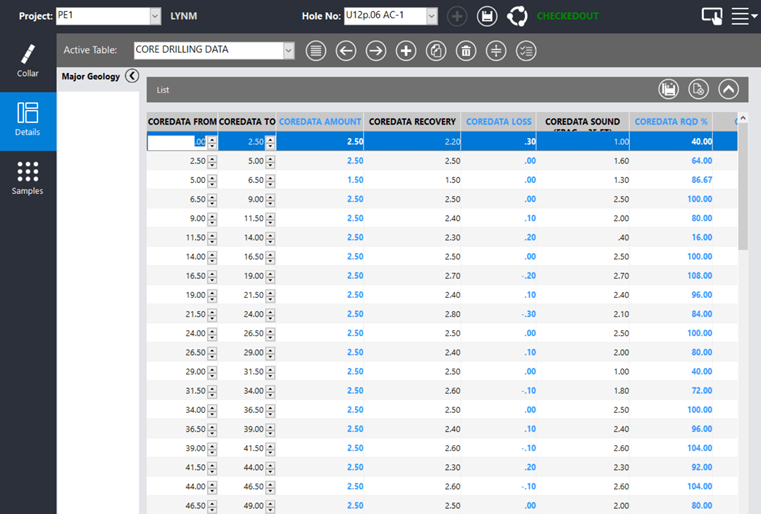
Following initial database quality assurance checks in early June, 30 Area 12 drillholes were initiated in the database. Five importers have been built to import data (survey, rock quality designation (RQD), preserved samples, geophysical fracture tables, and lithology). Data for these tables has been formatted and imports are near completion (see figure for example). Three additional importers are currently being built.
Another accomplishment this year came after geologists were informed of the existence of an old well logging database of geophysical log data that was planned for archiving. The database user had retired years before, and this project was unaware of this outdated database. IT and Database Administration have developed a solution so that we can query the well logging database, export the data, and import it into our centralized database.
Conclusions and Path Forward
Although the software is an industry standard, adapting it for use in the National Nuclear Security Administration enterprise proved to be an unprecedented accomplishment. And although it is still in its infancy, this newly established centralized geologic database will preserve our valuable legacy and modern data for the long term.
It will also allow geologists to leverage the compiled data in its entirety. This is something we have never been able to accomplish before. Modern geologic modeling software is designed to query and display borehole data from a centralized relational database. Completion of this project will allow us to rapidly display large datasets and to model larger areas across the NNSS. This capability will also allow us to spatially analyze complex geologic trends in 3D. This will benefit programmatic efforts by more quickly providing detailed characterization of active testbeds and areas of interest for future testbed development.
The database will also add value for current and future programs by modernizing our workflow. Historically, geologists captured data on paper logs and then later entered the data into spreadsheets. The database will allow us to enter new information directly into the database, whether collection occurs at the NNSS Core Library or in the field. This will be an additional cost saver for our ongoing projects. Recent updates to the Datamine Fusion software have added drill core photo management, which will allow geologists to attach images to the logs and annotate and comment directly onto the image. This can be done in the field during drilling and logging. There is also a drillhole visualizer that allows geologists to view the log data in 3D, directly from the logging application. As the software technology develops, we will advance our own capabilities, and the database will continue to develop its contributions to NNSS programs.
Publications
- Title: Material identification in radiographic images of mixtures by tuning the x-ray source spectrum using multiple anodes
Journal / Conference: JOWOG 32 HDT
Year: 2023
Author(s): B. La Lone, D. Sorenson, B. Valencia, T. Hartsfield, J. Goett, S. Baker, D. Morgan, S. Miller, N. Maserang